









Erdigo
GPS Utility for macOS & Windows — Enrich Your Travels and Adventures!
Erdigo turns your Mac into a full-featured GPS workstation. Connect a USB or WiFi GPS sensor for real-time tracking, overlay aviation and nautical charts, watch live aircraft and ships, measure distances and areas, plan routes, save offline maps, and keep every record safe with encrypted backups.

$9.99 One-time purchase · No subscription · All features included
Key Features
Everything you need for GPS navigation, aviation and marine mapping on macOS
Real-Time GPS Tracking
Connect a USB serial GPS sensor or receive location over WiFi (e.g. from an iPhone GPS-sharing app). Your position, heading and track are drawn on the map in real time — stable even on long sessions.
GPS Status · Satellites · NMEA
Three dedicated windows: reception status (coordinates, altitude, speed, HDOP, signal quality), a 360° satellite radar with per-satellite signal bars and PRN details, and a live NMEA console showing raw sentences.
Aviation & Nautical Charts
Overlay OpenSeaMap seamarks, OpenAIP airspace, NOAA nautical charts and FAA sectional charts on top of any base map — toggle each layer independently from the map context menu.
Live Aircraft & Ships
Display aircraft in flight (OpenSky) and vessels at sea (AIS) directly on the map, updated automatically. Great companion to the aviation and nautical chart layers.
Offline Maps
Save the current map region to your Mac and keep navigating without an internet connection — ideal for remote trails, open water and in-flight use.
Distance & Area Measurement
Right-click the map to measure point-to-point distances or polygon areas. Results stay on the map, can be deleted individually and can be shared as links.
Route Planning
Set a start and destination on the map to get a walking or driving route with distance and turn-by-turn segments. Switch transport mode with one click.
Live Altitude Graph
A scrollable elevation graph records altitude and geoid separation over time while a sensor is connected, and also visualizes elevation profiles of loaded GPX tracks.
GPX & NMEA Files
Open GPX routes and NMEA logs by drag & drop or double-click. Every live session is recorded and can be reloaded from the history list at any time.
Photo Pins
Attach photos to map locations to build a visual travel diary. Pins and photos are stored encrypted and can be revisited, edited or shared later.
Encrypted Backup & Restore
Back up all records with password-based encryption. Restore with overwrite or merge, and undo a restore thanks to the automatic safety backup taken beforehand.
Sharing & Stellarium
Share measurements, routes and pins as end-to-end encrypted links — recipients without the app see them in a web map viewer. Erdigo can also write your GPS sensor into Stellarium's config for star-gazing sessions.
Windows Edition Exclusives
Extra features added in the Windows edition — everything from the macOS version is included too
Place Search
Search any place name or address from the toolbar and jump straight to it on the map. Results are pinned and every query is kept in a searchable history you can clear at any time.
Waypoint Routing
Add stops between start and destination. Pick them on the map or by search, reorder or edit them, and the route is recalculated to pass through every waypoint.
Coordinate Formats
Switch how coordinates are displayed: decimal degrees, degrees-minutes-seconds (DMS), UTM or MGRS — useful for aviation, marine and field work.
KML / KMZ Support
Import KML and KMZ files alongside GPX, and export your routes and measurements back out to KML or KMZ for use in other mapping tools.
Photo EXIF Geotagging
Write GPS coordinates straight into the original photo file (JPEG EXIF), so your pictures carry their location with them outside the app.
Track Statistics
A statistics dashboard for any recorded track: total distance, moving and stopped time, average and maximum speed, plus total ascent and descent.
How to Use
Quick guides for the most popular features
Connect a GPS sensor
- Plug in a USB GPS sensor, open the connection panel at the top of the main window
- Pick the serial port and baud rate, then press Connect — the LED turns green on success
- No sensor? Use File → "Connect WiFi GPS…" to receive from an iPhone GPS-sharing app
Measure distance & area
- Right-click the map and choose "Measure Distance" or "Measure Area"
- Click points on the map — the total distance / area updates as you go
- Right-click again to stop; right-click a measurement to share or delete it
Plan a route
- Right-click the starting point and choose "Start Location"
- Right-click the destination and choose "Destination" — the route is calculated instantly
- Open "Route Info" for segments, and toggle between walking and driving
Aviation & marine layers
- Right-click the map to toggle OpenSeaMap, OpenAIP, NOAA and FAA chart layers
- Enable "Live Aircraft (OpenSky)" or "Live Ships (AIS)" in the same menu
- Layers stack on any base map (Standard, Satellite, Hybrid, OpenStreetMap)
Use maps offline
- Move the map to the region you need and set the zoom you want to keep
- Right-click → "Save Current Map Region" to download the tiles
- Manage saved regions in File → "Offline Maps…"
Back up & restore records
- File → "Backup Records (Password)" creates an encrypted backup file
- File → "Restore Records (Password)" restores it — choose Overwrite or Merge
- Made a mistake? File → "Undo Restore" returns to the automatic safety backup
Find a place by name
- Click "Search" in the toolbar to open the search panel
- Type a place name or address and press Enter
- Pick a result to move the map there — past searches stay in the history list
Add waypoints to a route
- Set a start and destination by right-clicking the map, as usual
- Right-click the route and choose "Add Waypoint" — pick it on the map or by search
- The route is recalculated through every stop; use "Edit Waypoints" to reorder or remove
Media Gallery
Watch Erdigo in action
Route Planning
Set a start and destination, get a route with distance, and follow it on the map.
Distance & Area Measurement
Measure distances and polygon areas directly on the map with a right-click.
Live GPS Reception
A real GPS sensor feeding the satellite radar, status window and NMEA console simultaneously.
Photo Pins Demo
Attach photos to map locations and build your travel diary.
Distance Measurement Demo
Classic point-to-point measuring on the map.
Screenshots
The 10 screens from the App Store — with usage tips
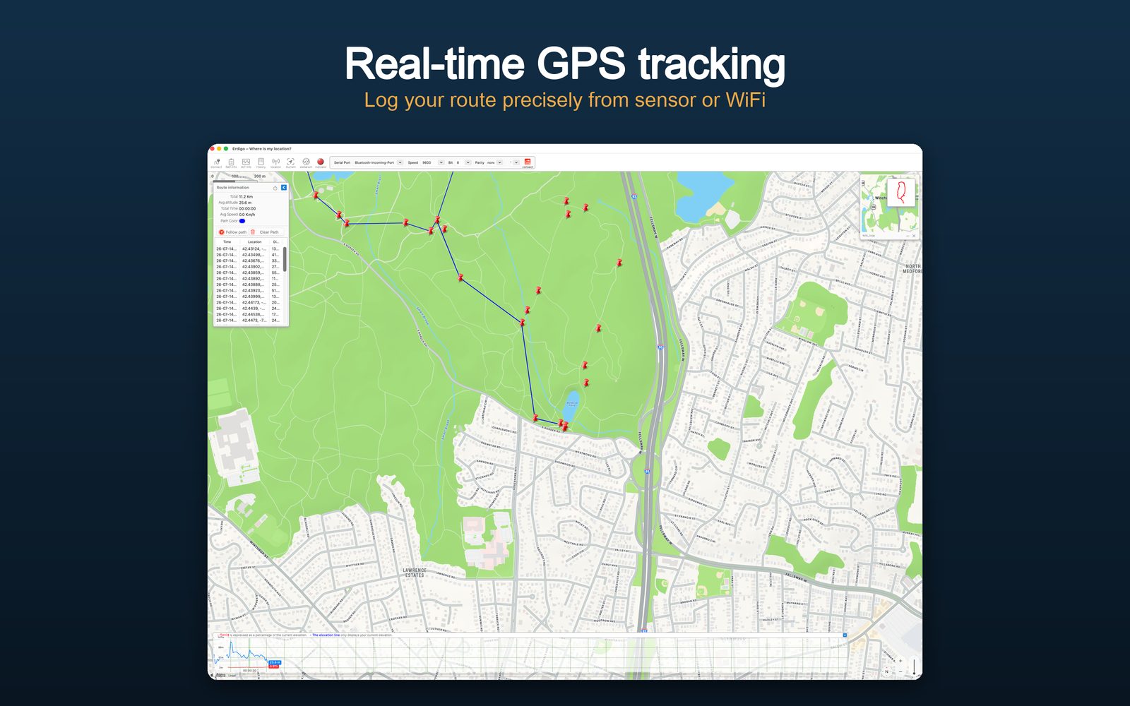
Map & Real-Time Track
With a sensor connected, your track is drawn live and the altitude graph below records elevation over time. Choose Standard, Satellite, Hybrid or OpenStreetMap as the base map in Preferences.
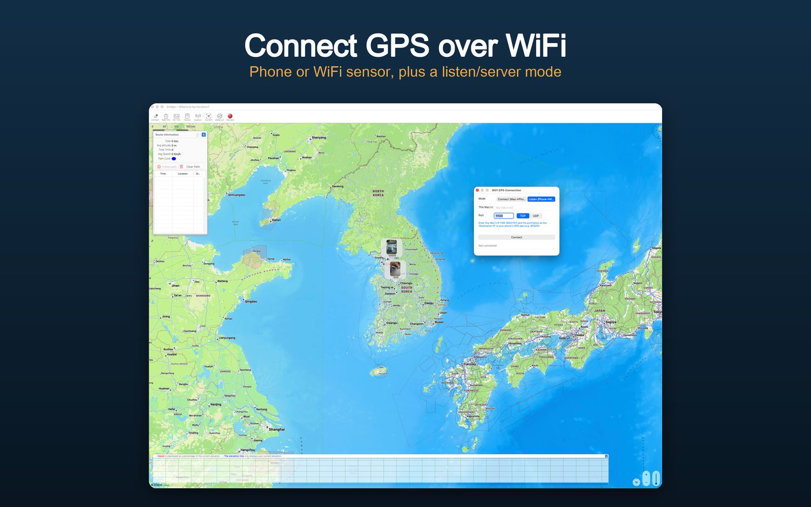
WiFi GPS Connection
No USB sensor? Receive location from an iPhone GPS-sharing app (e.g. GPS2IP) over WiFi: File → "Connect WiFi GPS…", enter the IP and port shown by the phone app, and connect.
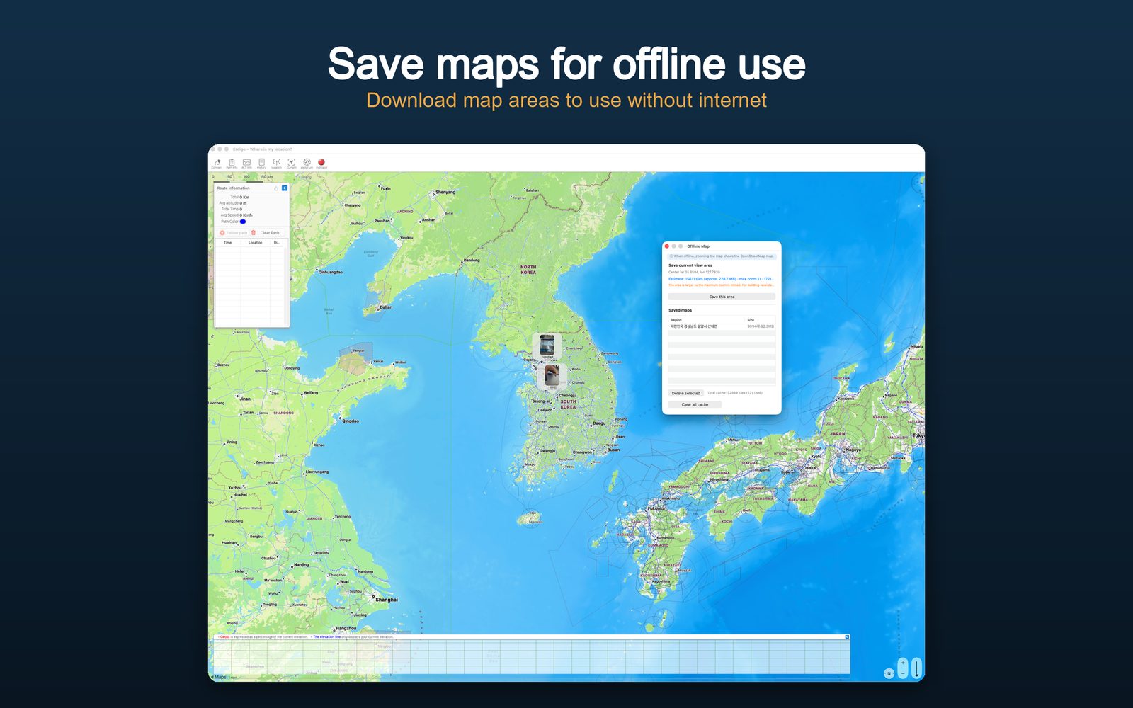
Offline Maps
Download the current map region for use without internet. Perfect for remote hikes and open water — saved regions are managed in File → "Offline Maps…".
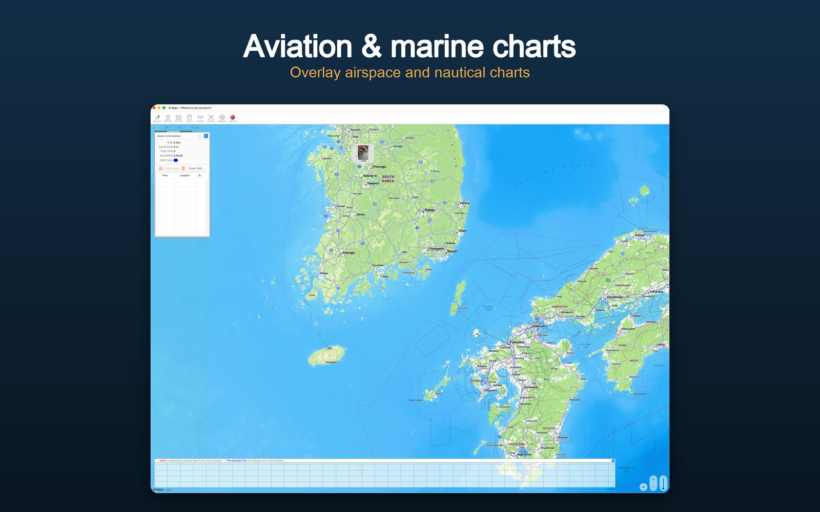
Aviation & Nautical Charts
OpenSeaMap seamarks, OpenAIP airspace, NOAA charts and FAA sectionals overlaid together, plus live aircraft and ships. Toggle each layer from the right-click menu.
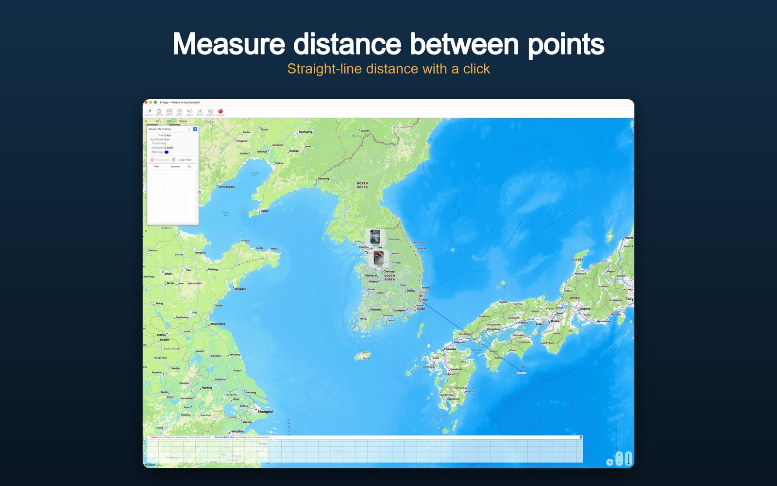
Distance Measurement
Right-click → "Measure Distance", then click waypoints; the total updates live. Measurements persist on the map and can be shared as links or deleted individually.
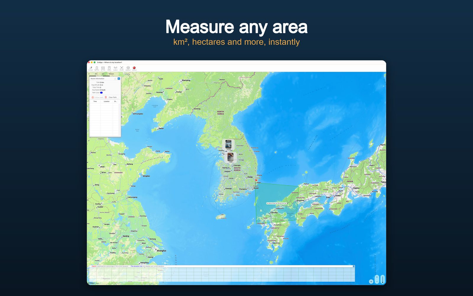
Area Measurement
Click the corners of any region to compute its area — useful for land, lakes or search zones. Stop with a right-click; the polygon stays until you delete it.
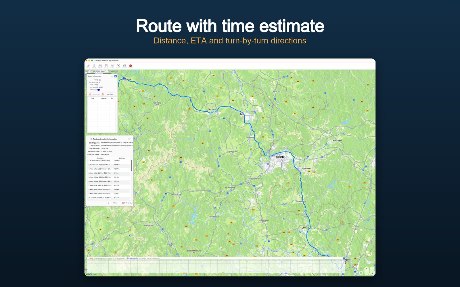
Route Planning
Pick start and destination via right-click to get a walking or driving route with total distance. The route info panel lists each segment.
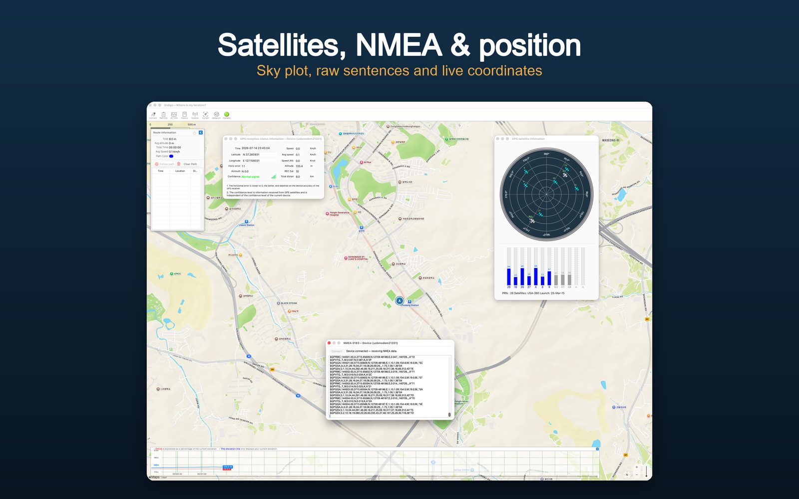
GPS Status · Satellites · NMEA
All three GPS windows at once: satellite radar with signal bars, reception status with coordinates / altitude / speed / HDOP, and the raw NMEA console (⌘G, ⌘I, ⌘T).
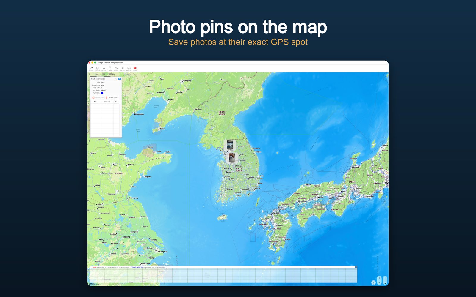
Photo Pins
Right-click → "Add Photo at Location" to pin photos onto the map. Photos are stored encrypted and make the map your visual travel diary.
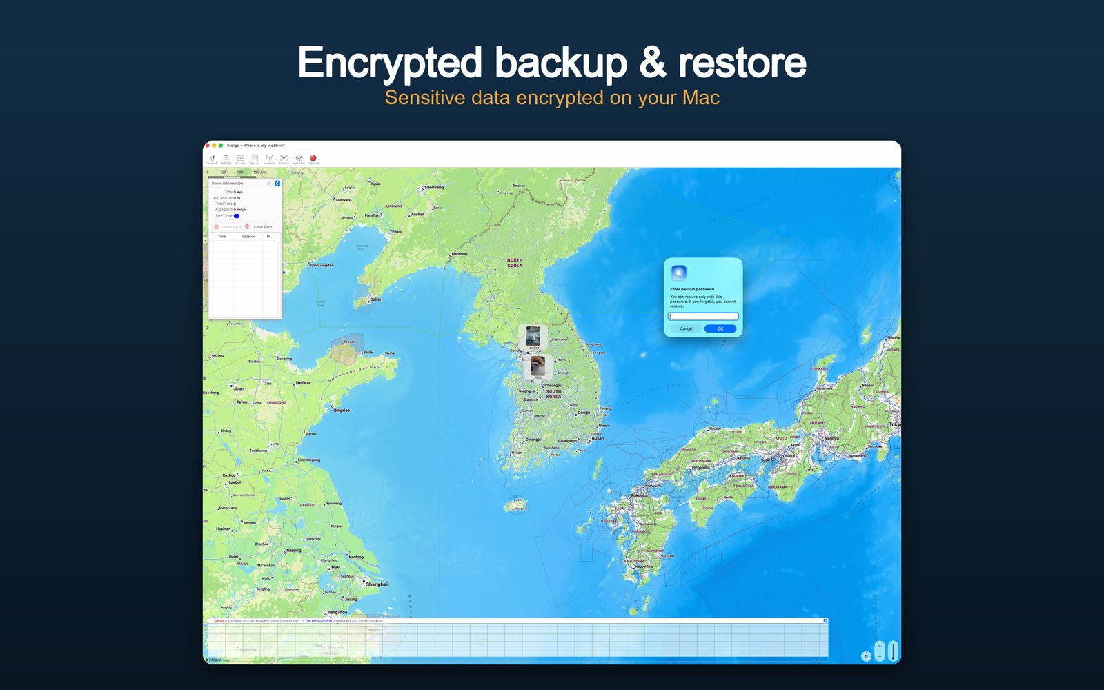
Encrypted Backup
Back up pins, photos and records to a password-encrypted file. Restore with overwrite or merge — an automatic safety backup lets you undo a restore.
System Requirements — macOS
- macOS 11.0 or later
- Intel or Apple Silicon processor
- 100MB available storage
- Internet connection (for map downloads)
- Optional: USB serial or WiFi GPS sensor for live tracking
System Requirements — Windows
- Windows 10 version 17763.0 or later (x86 · x64 · ARM64)
- Processor: 1 GHz or faster (2 GHz dual-core or faster recommended)
- Memory: 4GB minimum (8GB recommended)
- DirectX 9 minimum (DirectX 11 recommended) · Video memory 2GB (4GB recommended)
- 100MB available storage
- Internet connection (for map downloads)
- Optional: USB serial or Wi-Fi GPS receiver for live tracking
Pricing
- $9.99 (USD) — one-time purchase, yours forever
- No subscription, no in-app purchases — every feature included
- One of the most affordable full-featured GPS map apps: aviation & nautical charts, live aircraft/ships and offline maps in one, while many map apps charge monthly or yearly subscriptions
- Available in 8 languages: EN · KO · JA · ZH · ES · FR · DE · RU
Erdigo
GPS Utility for macOS & Windows — Enrich Your Travels and Adventures!
$9.99 One-time purchase · No subscription · All features included